FORECAST HIGHLIGHTS
-
COOL MORNING, WARM AFTERNOON: 60s –> 80s today
-
FRONT BY THU AM: Brings small rain chance, cooler weather
-
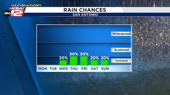
SMALL RAIN CHANCE: Thursday through weekend
-
AQUIFER/LAKES: Aquifer continues to rise, lakes slow to respond
FORECAST
TODAY/TOMORROW
After a stellar weekend, we’ll see warmer weather today. The day will start in the low-60s, but end up in the mid-80s, under mostly sunny skies
On Tuesday, morning fog and cloud cover is likely, then expect a partly cloudy afternoon. Temperatures will spike near 90 by the late afternoon.
MIDWEEK FRONT
Wednesday should be warm, too, before a front slides through early on Thursday. The front will give us a cool-down and bring some rain into the picture. Rain chances will stay on the low-end, but do stick with us into the weekend.
AQUIFER/LAKE CHECK
The aquifer continues to see a good bump. It’s up more than a 13 feet since April 17th. We’ll still need about 10 more feet to get to what we’d consider a “healthy” level.
Our lakes and reservoirs, which tend to take more time to fill up, are only slowly reacting the rainfall. We’ll need quite a bit more rain to see a real change in these numbers.
QUICK WEATHER LINKS
Copyright 2026 by TheTXLoop – All rights reserved.