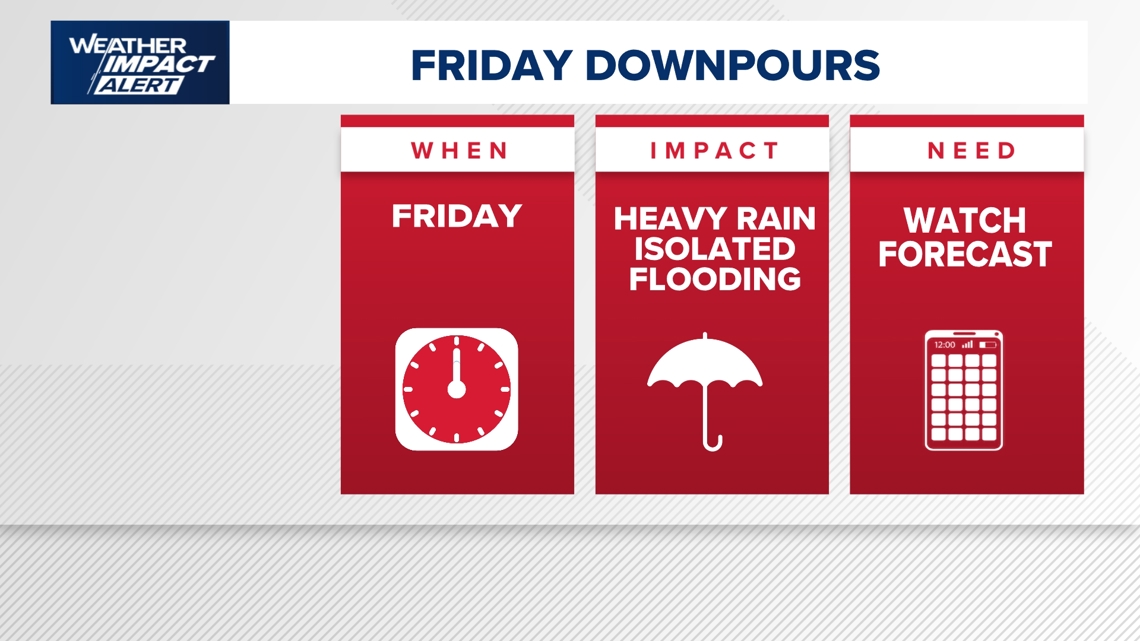
The KHOU 11 Weather Team has issued a Weather Impact Alert for Friday as heavy rain that could lead to flooding is in the forecast.
HOUSTON — The KHOU 11 Weather Team has issued a Weather Impact Alert for Friday because of expected widespread downpours, heavy rain, and the potential for isolated flooding that could create problems on the roads.
The greatest concern will come during the afternoon hours Friday, though the alert remains in effect for the entire day as conditions are expected to stay unsettled. Rainfall intensity and duration will be key factors, with the potential for flooding increasing into Saturday if heavy rain persists.
A cold front will slowly move toward Southeast Texas. It’s expected to sag south of Houston before lifting back north early Friday. That shift, combined with a developing low-pressure system moving in from the west, is expected to increase rain chances and keep the atmosphere unstable.
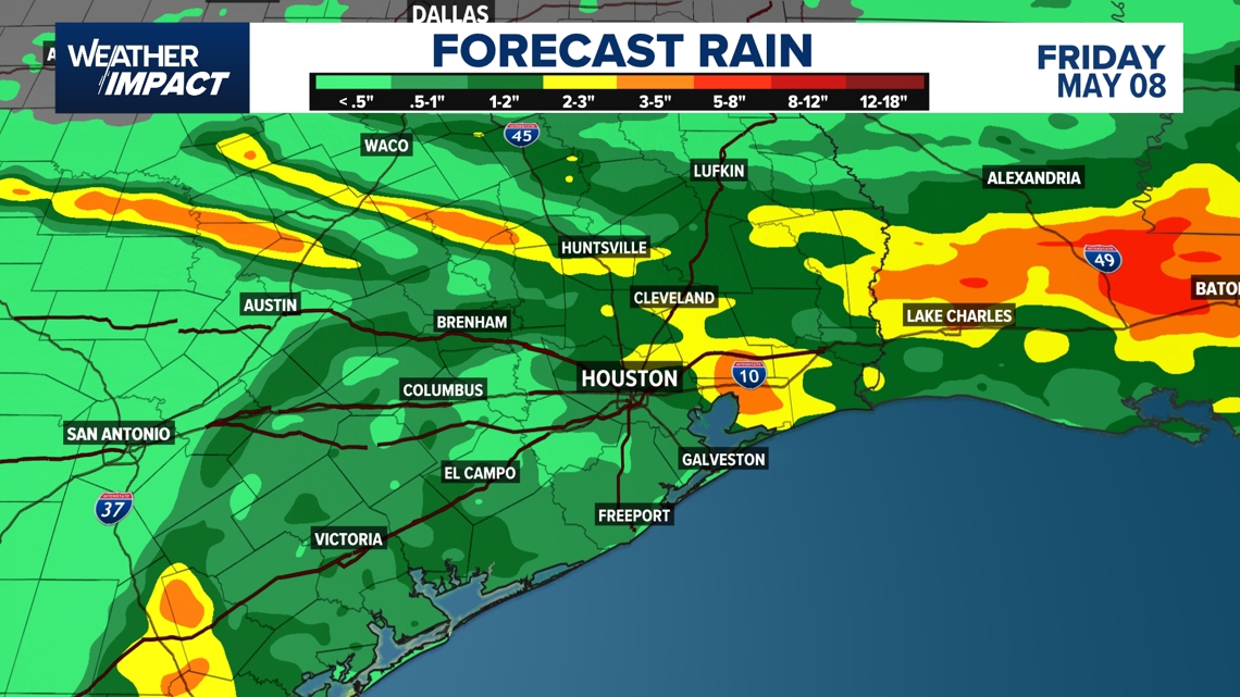
The setup could lead to widespread showers and storms Friday afternoon, with additional rounds of rain possible into Saturday evening. The system is not expected to clear the area until at least Sunday.
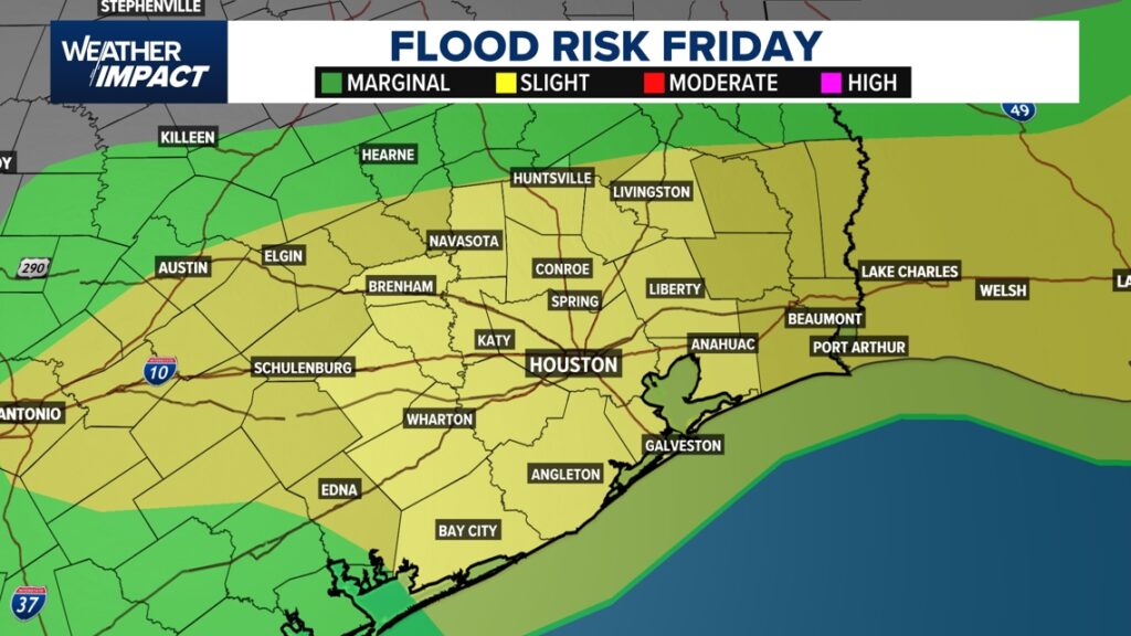
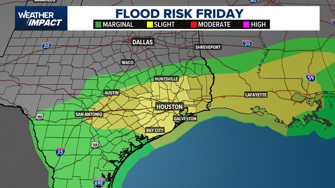
Most of Southeast Texas is under a slight risk of flooding Friday, which is a level two out of four. You’ll want to monitor the forecast closely and have multiple ways to receive weather alerts as conditions evolve over the next several days.
What to expect day-by-day:
Thursday: Cooler temperatures in the mid-70s as the cold front moves through. A few isolated showers may linger, but conditions are generally calmer compared to Friday.
Friday — Weather Impact Alert: Widespread showers and storms develop, especially in the afternoon. Heavy rain and isolated flooding are possible. The evening commute could be impacted by downpours and water on roadways.
Saturday: Unsettled weather continues with additional showers and storms. Flooding concerns may linger depending on how much rain falls Friday.
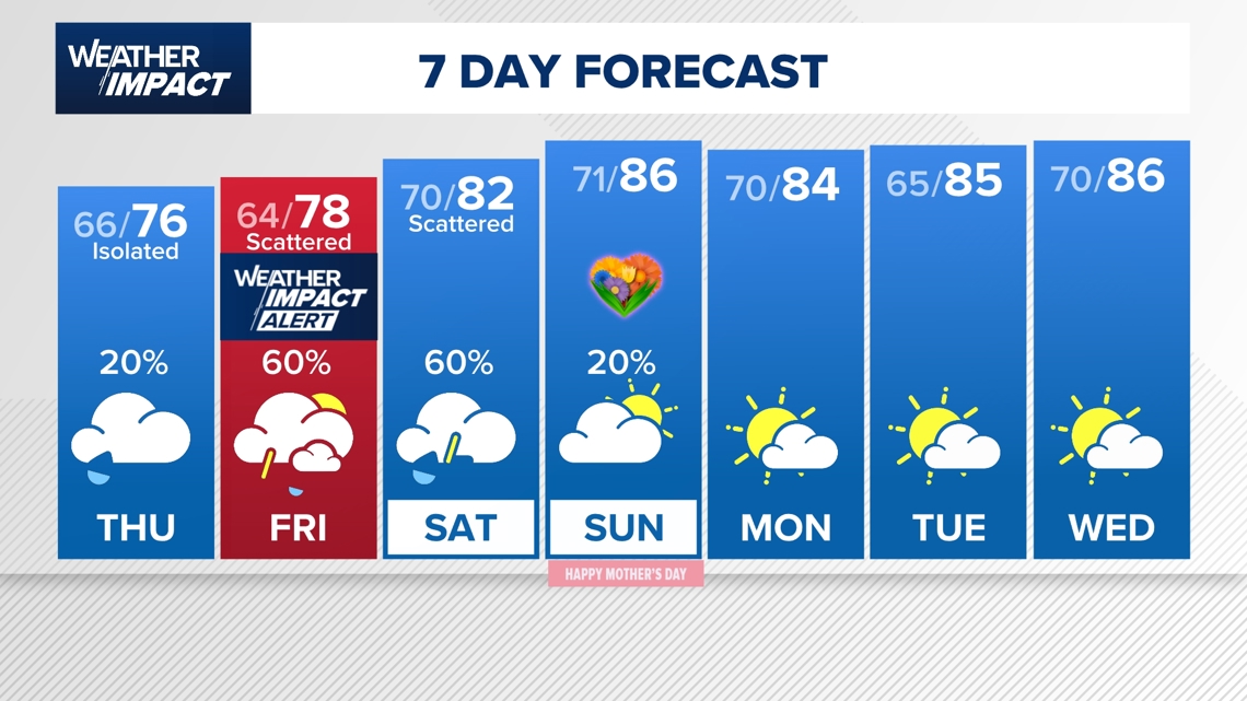
Sunday: A slight chance of lingering showers with mostly cloudy skies. Warmer and muggy conditions return, with highs in the upper 80s.
Early next week: Partly cloudy and mostly quiet conditions return, though the pattern remains generally warm and humid.
Silver lining: Drought relief on the way
The extended rainfall could have a significant upside. Much of the Houston region is currently under moderate to extreme drought conditions, though KHOU 11 Chief Meteorologist David Paul noted that last Friday’s heavy rain hasn’t yet been factored into the latest drought index update, which is due Thursday.
“We’re in the process of busting this drought,” Paul said, adding that the overall pattern favors wetter than normal conditions through mid-May.
Current conditions as of Tuesday evening: Partly cloudy skies, 82°F at Bush Intercontinental, with a humid south-southeast wind at 10 mph. Dew points have climbed into the low 70s — firmly in summertime territory for Houston.
Counties we serve:
Harris County (including Houston, Pasadena, Baytown), Fort Bend County (Richmond, Sugar Land, Missouri City), Montgomery County (Conroe, The Woodlands), Brazoria County (Angleton, Pearland, Alvin, Lake Jackson), Galveston County (Galveston, League City, Texas City), Liberty County (Liberty, Cleveland, Dayton), Walker County (Huntsville, New Waverly), Waller County (Hempstead, Prairie View, Waller), Polk County (Livingston, Corrigan), Chambers County (Anahuac, Mont Belvieu, Winnie), Wharton County (Wharton, El Campo), Washington County (Brenham), Matagorda County (Bay City, Palacios), Grimes County (Anderson, Navasota), Austin County (Bellville, Sealy), Colorado County (Columbus, Eagle Lake, Weimar), Trinity County (Groveton, Trinity).