
FORECAST HIGHLIGHTS
-
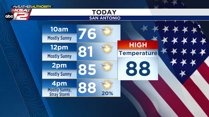
MEMORIAL DAY: Brief, AM clouds, mostly sunny PM, stray storm
-
TUESDAY NIGHT/EARLY WED: Storms likely, heavy rain possible
-
QUIETER THU/FRI: Drier weather for end of work week
FORECAST
MEMORIAL DAY
On behalf of the TheTXLoop weather team, we give thanks to the brave men and women who made the ultimate sacrifice. We are grateful for their service.
We’ll start Memorial Day with a few clouds, followed by mostly sunny skies by midday. With plenty of sunshine, temperatures will reach the upper-80s. A stray storm cannot be ruled out later today. While most will not see any rain, should a storm pop up where you are, heavy rain, lightning and thunder would all be possible.
STORMS LIKELY TUESDAY NIGHT
We’ll likely see a bit more cloud cover on Tuesday, but odds of rainfall will remain low until after sunset. Temperatures will return to the upper-80s.
By Tuesday night, upper-level energy will help to touch off storms to our west. These storms will move east overnight, bringing good chances for rain. These storms may be strong, while also producing heavy rainfall. Most of this activity will exit east before the Wednesday morning commute. However, wet roads and street flooding may remain a while longer.
QUIETER END TO WORK WEEK
After Tuesday night’s round of storms, odds for rain decrease. A few more pop-up storms may return Wednesday and Thursday afternoons. Friday looks to be rain-free. A front late in the weekend may help to stir up more storms for the Sunday to Monday timeframe.
QUICK WEATHER LINKS
Copyright 2026 by TheTXLoop – All rights reserved.