City officials said they are working on a project to fix an old, damaged storm sewer underneath an underpass along Navigation Boulevard.
HOUSTON — Heavy rain expected Friday could once again flood some of Houston’s most vulnerable streets and underpasses, including a trouble spot in East Downtown where city crews are working on a long-term fix.
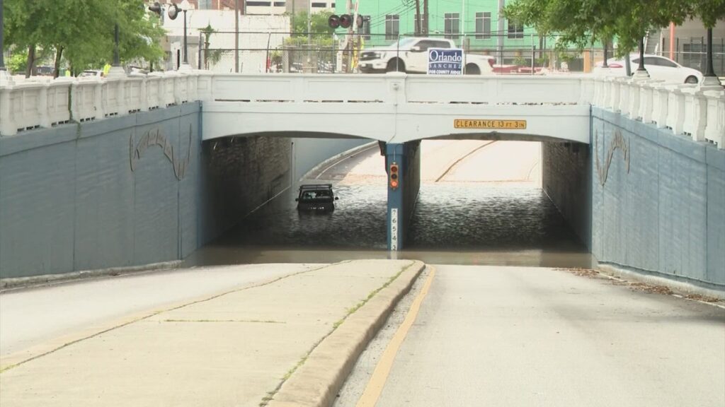
An interactive map compiled by KHOU 11 highlights several flood-prone areas across the city, including streets and underpasses that routinely take on water during storms. One of those locations is the underpass at Navigation Boulevard near Canal Street.
City officials said a damaged storm sewer, estimated to be about 90 years old, sits several feet beneath the underpass and is the primary cause of repeated flooding.
Even light rainfall can lead to rapid water accumulation in the area. A project is now underway to address the issue, though a timeline has not been set.
Repeated flooding incidents
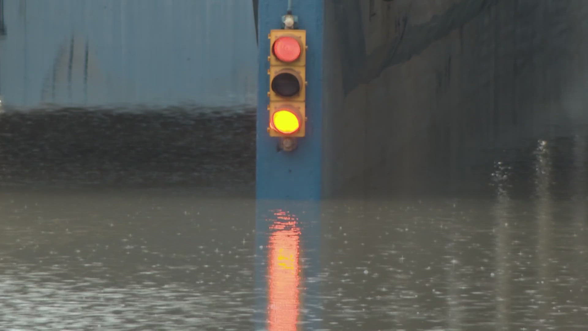
Video from April 1 shows fire crews rescuing a driver stranded in floodwaters at the Navigation underpass. The location has flooded multiple times in recent months.
Footage from October and June of last year shows similar scenes, with drivers stuck after attempting to pass through high water.
In response, the city installed permanent swing gates last year to block traffic when flooding occurs.
However, some nearby business owners said the measure creates additional issues. Brent Johnson, owner of Tires International – which is located right next to the underpass – said the gates can lead to gridlock that affects his operations.
“When my service techs need to get out, that can cause some problems because it backs up the traffic. We can’t get out right here. It’ll back it up this way,” Johnson said. “People have to go around and go over the bridge, versus going under the bridge, and if there’s a train there, nobody can go anywhere.”
Aging infrastructure, complex fix
According to the city, the constant flooding stems from a damaged storm sewer dating back to 1936, located roughly 25 to 40 feet underneath the underpass.
Houston Public Works said in a statement that the project to fix the issue is a high priority but also “an extremely complex one,” adding that “the timeline to address failures of decades old equipment is not yet available.”
The Navigation underpass is just one of several flood-prone locations across Houston. KHOU 11 asked city officials whether similar projects are planned elsewhere.
“As far as specific roadways and conditions, that would be more of a Public Works item to address with them,” said Brian Mason, director of the Houston Office of Emergency Management.
Community awaiting solutions
For those who live and work nearby, a permanent solution cannot come soon enough.
“There’s definitely a drainage issue, so it needs to be repaired sooner than later, so people can get around town a little bit easier,” Johnson said.
City officials said the project at Navigation and Canal is still in the investigation and assessment phase right now. Meanwhile, the East End District is installing two cameras at the site to help monitor conditions during storms, so crews can more quickly deploy the permanent swing gates.
Houston city officials said the underpasses at the following locations could become problematic if heavy rain falls:
- 100 Milam St
- 100 Shepherd Dr Fr
- 100 Yale
- 1000 Houston Ave
- 11600 West Park
- 11700 Richmond
- 11700 West Park
- 1200 Studemont
- 1200 Wayside
- 1500 North Main
- 1600 East Crosstimbers
- 1600 Jensen
- 1900 Kelly
- 200 75th
- 200 Forest Hill
- 2100 Franklin
- 2400 Harrisburg
- 2900 Allen Parkway
- 300 Studewood
- 3400 North Shepherd
- 3500 Kelly
- 3800 Polk
- 400 Houston Ave
- 4800 Elgin
- 4800 Memorial
- 4900 Galveston Rd
- 5000 Washington
- 5600 Mesa
- 600 Broadway
- 6500 Jensen
- 7000 Clinton
- 7000 Fannin
- 7000 Main
- 7000 Old Katy Road
- 7200 J W Peavy
- 7200 Senate Ave
- 8000 Memorial
- 8100 Harrisburg
- 8100 Hempstead
- 9600 Lawndale
Houston city officials said to look for flood signals in these areas if heavy rain falls:
- 4401 Elgin St (IH-45S and Railroad)
- 1989 Allen Pkwy (Montrose)
- 3087 Allen Pkwy (Waugh)
- Main & Holcombe Blvd (1000 Blk Holcombe)
- Fannin & Holcombe Blvd (1100 Blk Holcombe)
- 6514 Jensen Dr (Creston)
- 1700 Jensen Dr (Railroad)
- 3500 Kelley (Between IH-69 HOV and Jensen)
- 5800 Elysian St (North Loop 610 East)
- 7506 E Hardy Rd (Hardy Toll Road and Crosstimbers)
- 5405 Mesa Dr (Liberty and Railroad)
- 10704 W Little York Rd (Between Business Park and Sam Houston Tollway West)
- 774 Houston Ave (Memorial)
- 4450 Memorial Dr (Shepherd)
- Houston Ave & Center St (1100 Block Houston Ave)
- 600 Brooks St (North Main)
- 7220 Clinton Dr (North Wayside)
- Yale & Center St (100 Block Yale)
- 9600 Lawndale (Sims Bayou)
- 615 Broadway St (Between East Erath and East Elm)
- 8040 Harrisburg Blvd (Railroad)
- 306 S 75th St (Between Railroad and Rusk)
- 247 Forest Hill Blvd (Between Rusk and Capitol)
- 6598 Lawndale (Wayside)
- 3799 Polk (Milby and Railroad)
- 2050 Franklin St (Commerce)
- 5455 Old Spanish Trl (Spur 5 and Railroad)
- 4953 Galveston Rd (Allendale and Railroad)
- 10200 Old Katy Rd (Conrad Sauer)
- 7095 J W Peavy Dr (Railroad)
High Water Barricade Locations
Houston city officials said the following intersections or underpasses may be barricaded if flooding becomes a problem:
Got a news tip or story idea? Email us at newstips@khou.com or call 713-521-4310 and include your name and the best way to reach you.