Some storms could be strong to severe
FORECAST HIGHLIGHTS
-
OVERNIGHT: Storms becoming widespread, slight chance severe
-
FRIDAY: Off & on showers and storms (80%), windy & cool
-
WEEKEND: Cool mornings, sunny and pleasant afternoons
-
NEXT WEEK: Gradually warming, mostly dry
FORECAST
OVERNIGHT
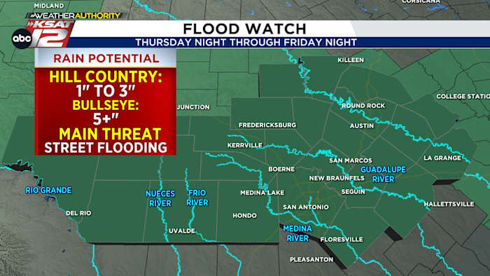
Storms slowly becoming widespread overnight and through the Friday morning commute. Locally heavy and beneficial rainfall is likely but could cause street flooding. Low‑lying and poor‑drainage areas (especially construction zones) is the main concern, along with the chance for gusty winds and localized hail.
FRIDAY
Off & on showers/storms will come and go through mid afternoon, as cooler air rushes in behind the front, keeping temperatures in the 60s.
Periods of heavy rain could lead to brief street flooding, and northeast winds may gust up to 40 mph, adding to the cool, raw feel. Storms begin shifting east by Friday evening as drier air moves in.
WEEKEND
The weekend brings a welcome change with a fall-like feel in the air. Mornings will be cool with temperatures in the lower 50s, then warming into the 70s during the afternoons under a good amount of sunshine.
QUICK WEATHER LINKS
Copyright 2026 by TheTXLoop – All rights reserved.