Meteorologists say a developing El Niño could become extremely strong and potentially bring wetter weather to Houston and Texas.
HOUSTON — Meteorologists say a developing El Niño could become a “super” El Niño by this fall or winter, a pattern that could influence weather around the world and bring changes to Southeast Texas.
NOAA says there is a two-in-three chance this El Niño becomes strong or very strong. Some models show it could become the most powerful on record.
What is El Niño?
El Niño is a natural weather pattern that warms the Pacific Ocean and can trigger extreme weather around the world.
KHOU 11 Meteorologist Kim Castro explained that a typical Pacific pattern may have sea surface temperatures around 80 degrees. During El Niño, those waters warm up. A stronger, or “super,” El Niño would mean the Pacific gets even warmer.
What could El Niño mean for Houston?
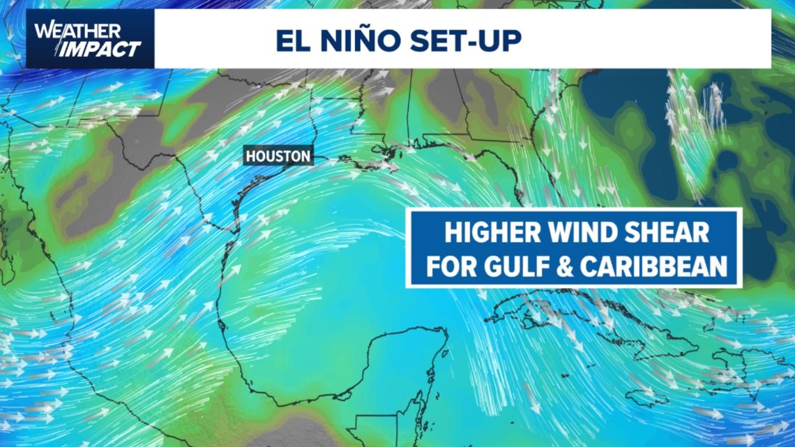
For the Gulf Coast, one of the biggest effects of El Niño is increased wind shear. Castro said that means stronger westerly winds can help break storms apart.
El Niño can also push the southern jet stream farther north, bringing more shower activity and typical thunderstorms to southern states, including Texas.
Even though Southeast Texas is currently in a neutral phase, Castro said the region is already seeing a wet pattern.
“So far, the month of May has been pretty wet, and we’re going to continue on that trend through the latter half of the month,” Castro said.
Got a news tip or story idea? Email us at newstips@khou.com or call 713-521-4310 and include the best way to reach you.