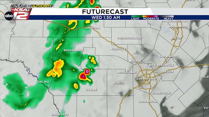
Rain tonight should last through about 3am
FORECAST HIGHLIGHTS
-
TONIGHT: Cluster of scattered showers/storms closer to Rio Grande will move into the western Hill Country through 3am
-
WEDNESDAY & THURSDAY: At or near 100°
-
FRIDAY & SATURDAY: Mid 90s, slight chance of rain
FORECAST
TONIGHT
Cluster of scattered storms and downpours will move from near Eagle Pass northward toward Uvalde, then into the western Hill Country tonight. Localized heavy rain could cause 1″-3″ in spots.
TEMPERATURES
July is now acting more July-like around San Antonio with temperatures at or just shy of triple digits the next few days. We’ll drop a smidge into the mid 90s Friday and Saturday as our next chance of rain arrives.
NEXT RAIN CHANCE
An upper-level disturbance is currently over the Bahamas and will move across the Gulf bringing rainmaking energy our way Friday into Saturday, but don’t expect much in terms of coverage or accumulation. Flooding and severe weather is unlikely.
This is *not* the kind of system that could turn into a tropical storm.
QUICK WEATHER LINKS
Copyright 2025 by TheTXLoop – All rights reserved.