FORECAST HIGHLIGHTS
-
WATCHING WEST TEXAS STORMS: This activity likely stays north of SA
-
BETTER ODDS TONIGHT, WEDNESDAY: Showers, storms possible
-
SEVERE?: Hail, gusty winds with stronger storms
FORECAST
The next 48 hours will feature chances for showers and storms. While the odds are good, it doesn’t mean everyone will get rain, nor will it be raining the entire time. In this pattern, we typically watch for clusters of storms.
TODAY
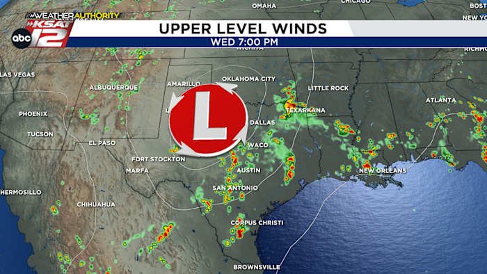
We’ll keep an eye on storms that are moving out of West Texas this morning. Based on the latest models, these likely miss San Antonio to the north. That means we’ll see partly cloudy skies and hot temperatures again today. An upper low moving out of New Mexico will generate more storms this evening to our west. These have higher odds of making it to South Texas tonight.
WEDNESDAY
There’s a possibility that we’re waking up to storms tomorrow. If that doesn’t pan out, then outflow boundaries from storms overnight may kick up more activity tomorrow. The upper low will help to give us lift. But as it often goes around here, what happens during the nighttime hours will dictate what we see during the day. We’ll update the forecast accordingly. Either way, have the umbrella on standby tomorrow.
WEDNESDAY NIGHT/THURSDAY
Once again, storms could roll through Wednesday night into Thursday morning.
WHAT TO KNOW
-
Isolated severe storms are possible anytime over the next several days
-
Street flooding will occur with the heavier clusters of storms
-
Commutes could be affected
QUICK WEATHER LINKS
Copyright 2025 by TheTXLoop – All rights reserved.