AUSTIN (KXAN) – “Buzzsaw”, “fish storm”, and “stadium effect” are all terms you might hear meteorologists use during hurricane season. But what do they mean?
Below is a list of official (and unofficial) words and phrases used to describe tropical storms and systems.
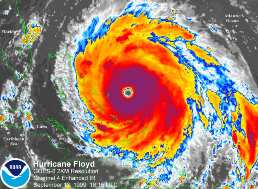
- “Buzzsaw”: A metaphor used to describe a powerful or destructive storm, as it can take on the look of a buzz saw on satellite imagery
- “Fish storm”: A term used when a tropical system is expected to remain over the ocean, not impacting land. (It’s important to know that these storms can affect fishing and travel routes.)
- “Saffir Simpson Scale”: As defined by the National Hurricane Center, “a 1 to 5 rating based only on a hurricane’s maximum sustained wind speed.” This scale does not account for other hazards, such as storm surge, rainfall, tornadoes, and inland flooding.
- “Stadium effect”: Used to describe the visual phenomenon of the inner eyewall expanding with height within strong tropical systems (similar to standing on a field and looking up in a sports stadium)

- “Eye”: The center of a storm that often ranges between 20-40 miles, often associated with calm weather
- “Eyewall”: The strongest part of a hurricane made up of powerful towering thunderstorms
- “Cone of uncertainty”: A forecast tool used by the National Hurricane Center that shows the most probable track of a tropical system’s center
- “Outer bands”: Dense lines of thunderstorms extending 50 to 300 miles long
- “Hurricane-force winds”: Winds at or above 74 mph
- “Tropical storm force winds”: Winds between 39-73 mph
- “Hurricane Hunters”: Specialized aircraft that are purposely flown into tropical storms and hurricanes to collect data. Aboard are NOAA meteorologists and pilots who record measurements and drop instruments through the eyewall of a storm in efforts to find the center and strength of a storm

Stay with the KXAN First Warning Weather team throughout the season for tropical updates. You can also stay up to date using our online Tropical Tracker.