Harris County offers an interactive flood map to help homebuyers assess flood risks.
HOUSTON — As the Bayou City dries out from the latest round of heavy rain, experts are reminding residents and homebuyers that flooding is always a possibility, and there are tools available to help prepare.
Whether you’re in the market for a new home or already settled in, understanding your flood risk is critical. Fortunately, Harris County and the National Weather Service (NWS) provide resources that can make a big difference.
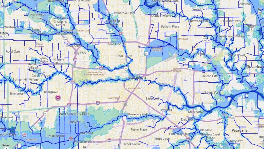
Harris County’s Interactive Flood Map
One of the most accessible tools is an interactive floodplain map offered by Harris County. The map shows floodways, 100-year floodplains, and 500-year floodplains, key indicators of how likely certain areas are to flood.
“This is super useful for anyone who’s planning to buy a home,” said KHOU 11 Meteorologist Kim Castro.
More from Homebuyer’s Week
Real-time flood forecasting from the NWS
For current homeowners or anyone monitoring flood conditions during storms, the National Weather Service provides flood inundation and extent maps.
“What we have are flood inundation maps or flood extent maps, which will actually show you the extent [of] flooding further upstream or downstream from those rain gauge locations,” said Katie Landry-Guyton, senior service hydrologist at the NWS.
Landry-Guyton explained that some maps offer real-time analysis of current flooding, while others include a forecast component to show how conditions could change based on rainfall predictions.
These NWS maps are available online and offer real-time forecasts and predictive ranges to help you stay ahead of potential flooding.
Currently, there are no active flood warnings in the Houston area, but experts say staying informed is key, especially with hurricane season underway.
Bookmark the Harris County Flood Education Mapping Tool and the NWS Flood Inundation Mapper to monitor your property’s risk and make smarter decisions before the next storm hits.