Stop guessing where to find shade at Plano parks. This new mobile tool lets you slide through the day to see exactly when and where to avoid the sun.
PLANO, Texas — As the North Texas heat begins to settle in, the City of Plano is giving everyone a new way to stay cool while enjoying the outdoors.
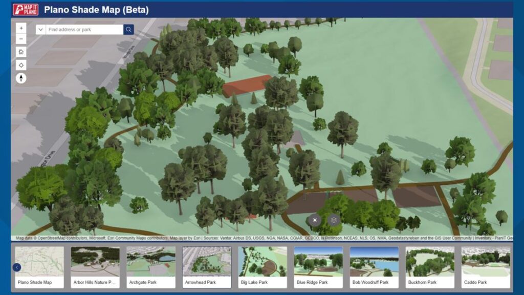
The city recently launched an interactive shade map designed to help park-goers track sunlight and shadow patterns across local parks. By selecting a specific date and time, users can see exactly where shade will fall, allowing them to plan visits during the most comfortable parts of the day.
The project was sparked by a resident’s question on social media regarding the best times to visit parks to avoid the sun.
“This tool helps residents take the guesswork out of planning a park visit,” said Dave Angeles, Parks and Recreation Assistant Director. “By showing how shade moves throughout the day, it gives people the ability to choose the time and place that works best for them.”
The tool uses a slider interface that reflects shifting landscapes across different seasons. It is accessible on both desktop and mobile devices, though the city noted the mobile version offers increased functionality for those already at a park.
To create the map, several city departments—including Planning, GIS, and Urban Forestry—collaborated to model the data. The shade patterns are based on the city’s 2023 Urban Forestry tree inventory, which tracks tree types, sizes, and canopy coverage.
Currently in its beta phase, the tool uses generalized models for trees and buildings. City officials noted that while some features, such as playgrounds, may not yet perfectly match real-world conditions, the map will be updated as more data is collected.
Residents seeking a little shade can access the interactive tool at plano.gov/shademap.