
Witnesses report seeing a funnel cloud southwest of Santa Fe, Texas.
SANTA FE, Texas — A funnel cloud was seen in Brazoria County, according to witnesses and reports sent to the National Weather Service on Tuesday.
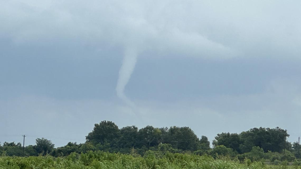
A KHOU 11 viewer sent a picture to the newsroom. It shows a rope-like cloud that does not appear to be touching the ground.
You can send us pics, too! Just text us at 713-526-1111 or email newstips@khou.com.
Travis Gordon said he was in Alvin when he saw the funnel cloud.
It happened at about 1:05 p.m., according to the National Weather Service. The NWS said a photo was taken from FM 2917, three miles west of FM 2004.
Funnel cloud versus tornado
A funnel cloud is basically what you see when a thunderstorm starts to spin and create that distinctive funnel shape made of water droplets extending down from the cloud base. The key thing is that it’s still hanging in the air – it hasn’t touched the ground yet.
You’re looking at a rotating column of air that’s visible because of all the condensation, but as long as it stays up there without making contact with the surface, it’s just a funnel cloud.
Now, the moment that same rotating column of air reaches down and touches the ground, everything changes. That’s when it officially becomes a tornado – a violently spinning column of air that’s connected to both the thunderstorm above and the ground below.
You’ll know it’s made contact either because you can see the condensation funnel physically touching down, or because debris and dust are getting kicked up from the surface. Once you see that ground connection, you’re no longer looking at a funnel cloud – you’re looking at a tornado.