FORECAST HIGHLIGHTS
-
SPOTTY DOWNPOURS: Expect a repeat of yesterday’s afternoon activity
-
LOWER RAIN CHANCES: Thursday, Friday bring less coverage of rain
-
WAY TOO EARLY 4TH FORECAST: As of now, trending hotter for 4th of July
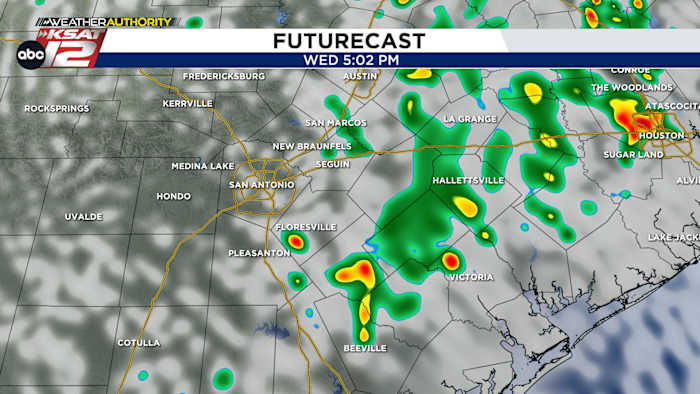
FORECAST
For those who got rainfall yesterday, it brought a welcome 0.25″ up to 0.75″. The airport, the official reporting site, did not see a drop. We’ll play the downpour lottery again today, with some around San Antonio seeing similar results.
TODAY’S FORECAST
Showers are already developing along the coast. These will slowly work inland through midday and then make a run at San Antonio this afternoon. We’ll keep rain chances at 30% for the 2pm-7pm timeframe. Like yesterday, it’ll be spotty.
LOWER RAIN CHANCES
A less favorable setup for afternoon rain takes over Thursday and Friday. With that said, isolated activity is still possible. Temperatures will continue to reach the low to mid-90s both days.
WEEKEND FORECAST
On Saturday, we’ll see another push of deep moisture from the Gulf. That’ll up our rain chances slightly. Isolated activity will continue on Sunday.
NEXT WEEK & INDEPENDENCE DAY
Next week’s forecast is trending drier and hotter. The heat high is going to attempt to build overtop of us by the end of the week. That means that, as of now, Independence Day is looking hot. We could be nearing 100 in San Antonio. It’s early, though, and things can change. We’ll have more updates ahead.
QUICK WEATHER LINKS
Copyright 2025 by TheTXLoop – All rights reserved.