HOUSTON — After a dry and warm start to the day, storms are expected to redevelop this afternoon across Southeast Texas. A Weather Impact Alert is in effect for Friday afternoon as heavy rain could lead to street flooding during the evening commute.
Friday starts off dry, but the storm risk ramps up into the afternoon and evening.
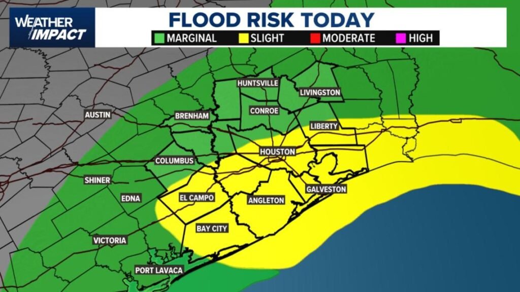
These regions remain vulnerable due to recent heavy rainfall and saturated soils.
Harris County (including Houston, Pasadena, Baytown), Fort Bend County (Richmond, Sugar Land, Missouri City), Montgomery County (Conroe, The Woodlands), Brazoria County (Angleton, Pearland, Alvin, Lake Jackson), Galveston County (Galveston, League City, Texas City), Liberty County (Liberty, Cleveland, Dayton), Walker County (Huntsville, New Waverly), Waller County (Hempstead, Prairie View, Waller), Polk County (Livingston, Corrigan), Chambers County (Anahuac, Mont Belvieu, Winnie), Wharton County (Wharton, El Campo), Washington County (Brenham), Matagorda County (Bay City, Palacios), Grimes County (Anderson, Navasota), Austin County (Bellville, Sealy), Colorado County (Columbus, Eagle Lake, Weimar), Trinity County (Groveton, Trinity).