FORECAST HIGHLIGHTS
-
WATCHING FOR A FEW SHOWERS THIS AM: Most of us stay dry
-
STORMS TONIGHT?: It’ll depend on what develops to our NW
-
BEST ODDS FOR RAIN: Wednesday/Wednesday night
FORECAST
After a humid, hot weekend, a shift in the pattern will provide us with rain chances this week. Will it be a drought buster? Likely not. But, a few of us could see some good rainfall.
TODAY
A complex of showers and storms is moving through Central Texas this morning. Its current trajectory takes it east of San Antonio. However, we could get clipped by a few showers. We’ll watch, but most of us stay dry.
The rest of the day calls for partly cloudy skies, along with hot & humid conditions.
TONIGHT/TUESDAY MORNING
In the pattern we’re moving into, we’ll need to keep an eye on overnight storm complexes (like we saw in May). So is the case tonight. Any storms that can cluster together in West Texas will have the potential to move toward South Texas tonight and into Tuesday morning. It’s not a guarantee, but should it unfold this way, the Tuesday morning commute could be affected.
SHOWERS & STORMS WEDNESDAY
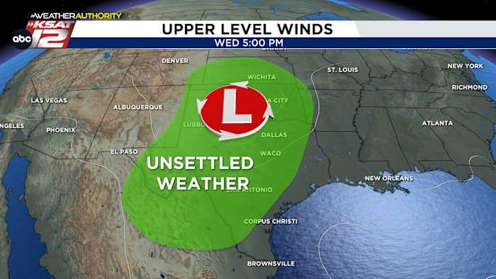
An upper level low will develop and slowly track through Texas Wednesday into Thursday. This will give lift to showers and storms. Once again, we’ll also be watching for any nighttime clusters of storms that could move through South Texas. Severe weather is possible, along with pockets of heavy rainfall.
QUICK WEATHER LINKS
Copyright 2025 by TheTXLoop – All rights reserved.
