
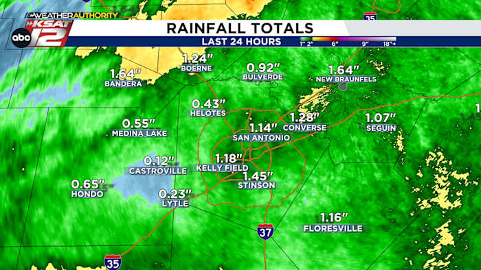
1″+ was common across the San Antonio area
FORECAST HIGHLIGHTS
-
STORMS SOUTH OF SA: Another round of storms affecting southern counties
-
RAINFALL: Totals from last night’s storms averaged 1-2″
-
QUIETER PATTERN AHEAD: We’ll get a chance to dry out next few days
FORECAST
THIS MORNING
After a busy overnight, another round of storms is moving west to east across the southern part of our viewing area. This activity will stay mainly south of San Antonio. However, some light rain could briefly push into the city for a time this morning. This area of storms will push east of us by mid-morning.
THIS AFTERNOON
Skies will begin to clear around midday and we’ll see quite a bit of sun by late afternoon. Still, highs today will only reach the low-80s. It will be humid thanks to yesterday’s rainfall.
RAINFALL TOTALS/DAMAGE REPORTS
Most of the San Antonio picked up at least 1″ of rainfall overnight. Higher totals were noted across Kendall County and parts of Frio County. Thankfully, damage reports, so far, have been minimal. If you sustained any damage, make sure and upload your pictures to TheTXLoop Connect.
QUIETER WEATHER AHEAD
Thursday and Friday will generally be dry. The Saturday night through Monday timeframe brings a chance for isolated showers and storms (30%).
QUICK WEATHER LINKS
Copyright 2026 by TheTXLoop – All rights reserved.