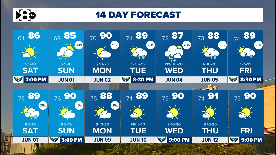
DFW weather stays dry through Saturday, but storms chances will return late Sunday. And severe storm chances could bring with hail, wind and lightning next week.
DALLAS — Watch live radar and regular forecast updates from our meteorologists on our Smart TV streaming app WFAA+ and download the WFAA mobile app for alerts from our weather team as they come.
Key Takeaways:
- Dry and pleasant weather through Saturday.
- Storms return late Saturday night into Sunday morning
- An unsettled pattern returns next week
- Daily chance for strong to severe thunderstorms, especially Tuesday and Wednesday
A nice start to the weekend
Enjoy the calm while it lasts! After Thursday’s cold front, highs were cooler on Friday across DFW. Expect a mild night on Friday with lows dipping into the upper 50s to mid-60s.
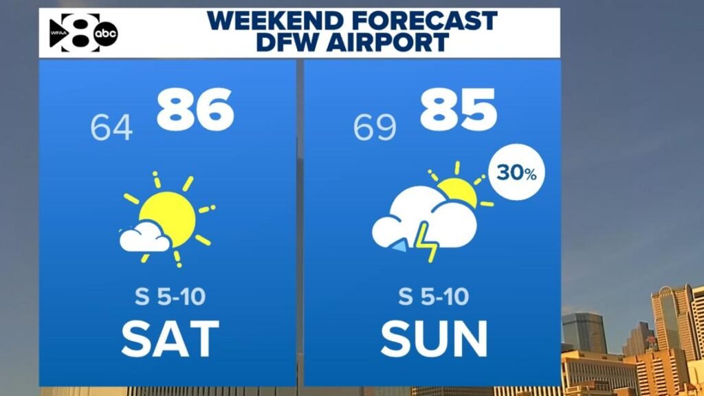
Saturday stays dry and a bit warmer, with highs climbing into the 80s. You may notice a hazy look to the sky, too — that’s smoke from Canadian wildfires drifting in on northerly winds.
Storms chances return Saturday night into Sunday
Chances for rain and storms increase late Saturday night into Sunday morning. Severe weather is not expected, but a few storms could be strong. Not everyone will see storms, and not every storm will be severe. The storms will generally move south and out of North Texas on Sunday morning.
Looking ahead to next week
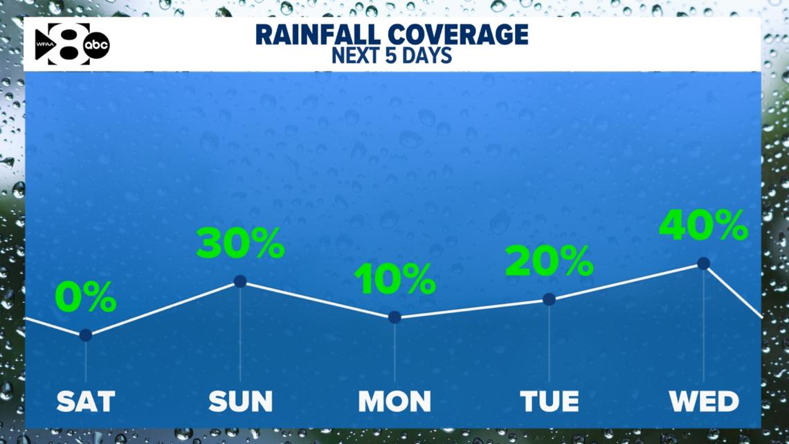
It’s shaping up to be an unsettled week. We’re expecting storm chances every day, mainly in the afternoon and evening.
Right now, Tuesday and Wednesday look like they’ll be the most active days. Some of these storms may turn severe, with hail and strong winds being the main threats. As of now, the tornado threat looks low, but we’ll keep a close eye on things.
Temperatures will stay near-normal throughout the week with afternoon highs mostly in the mid 80s to low 90s. Mornings will feel humid, with lows in the mid 60s to mid 70s.

14-day Forecast