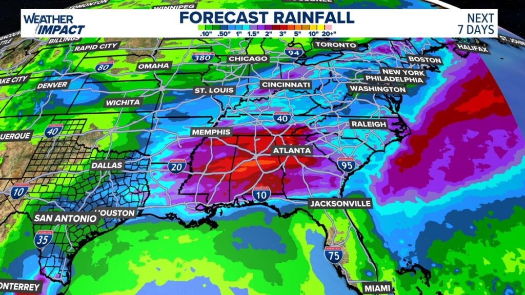
A stalled front will fuel rounds of rain across Texas to the Carolinas, potentially disrupting holiday travel and outdoor plans with locally heavy downpours.
This upcoming holiday weekend could bring a noticeable shift in weather across the South, Southeast, and Mid-South as a stalled cold front interacts with an upper-level disturbance moving in from the west.
Keep this in mind if you’re traveling this weekend.
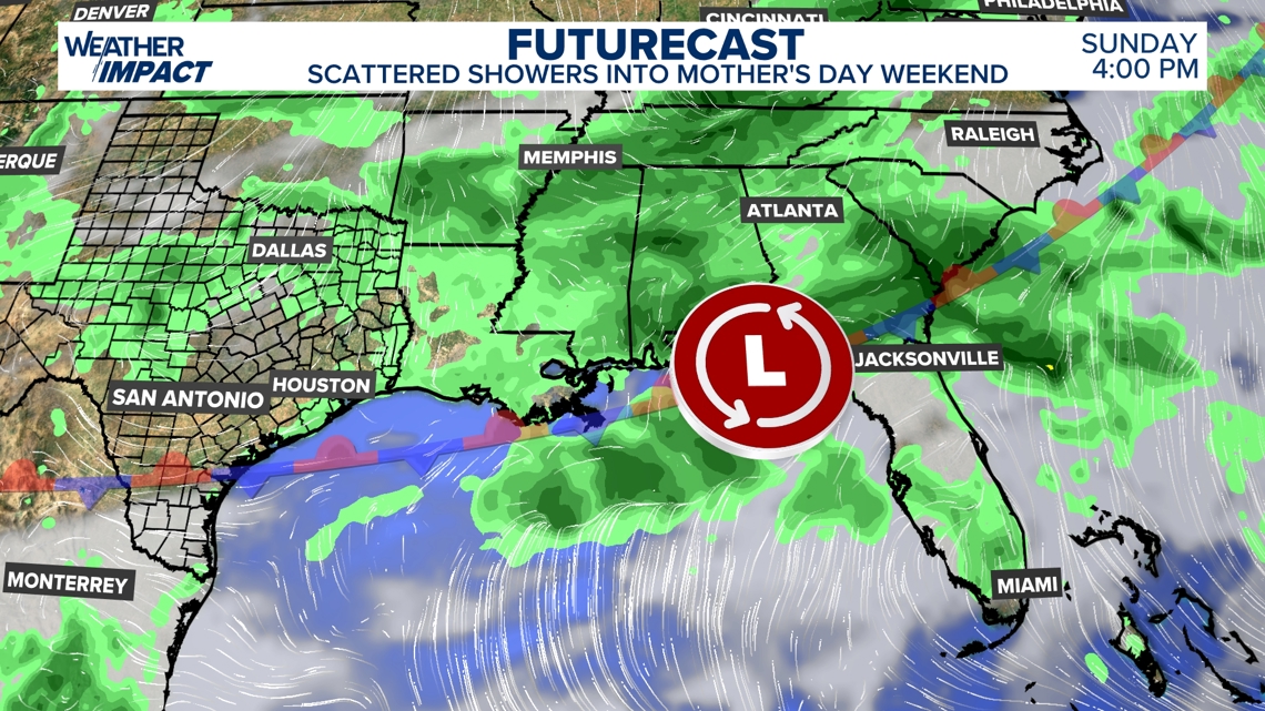
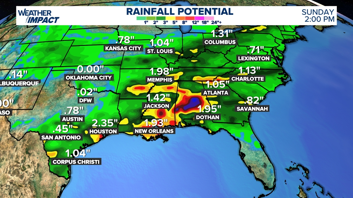
Scattered rain could slow things down, with pockets of heavy rain bringing a minor flooding risk into Saturday and Mother’s Day.
The boundary between cooler-than-normal air and warmer, moisture-rich Gulf air will act as a focus for scattered rainfall stretching from Texas through the Deep South and into the Carolinas. While the system is not expected to be a single, fast-moving storm, its slow progression means periods of steady rain and embedded heavier downpours are likely in several states.

As the system lingers into Saturday and potentially Mother’s Day, the main concern will be localized flooding in areas that receive repeated rounds of rain or heavier bursts of precipitation. Urban areas, low-lying spots, and already saturated ground will be most vulnerable, especially where storms train over the same locations.
This system looks to gradually clear Texas and parts of Louisiana by Mother’s Day, but the focal point for rain will remain east. Mainly between Mississippi and the Carolinas.
While not everyone will experience severe impacts, the overall setup supports a wet and sometimes disruptive holiday weekend, with travel delays and changing outdoor plans possible across parts of the region.
Be sure to keep up with local forecasts and daily updates!