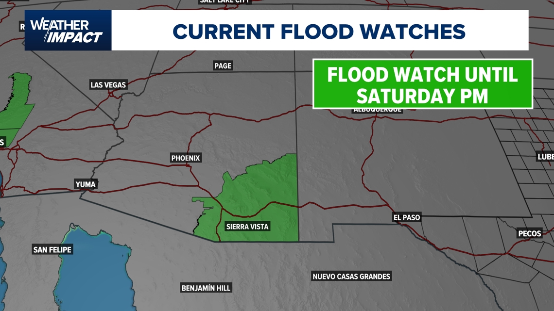
Remnants from Lorena will prompt Flash Flood Watches for portions of the Desert Southwest.
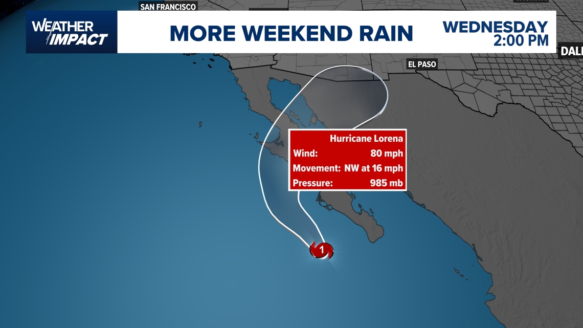
HOUSTON — The tropics have been quiet for the past few weeks, but as we head closer to the peak of hurricane season, activity is ramping up in both the Pacific and Atlantic basins. Hurricane Lorena in the Pacific Ocean is expected to make landfall in Baja California and southwestern Sonora by Thursday, bringing heavy rainfall concerns.
This will increase the risk of life-threatening flash floods and mudslides across Mexico, especially in areas with higher terrain.
As the storm weakens, remnants of the storm will bring tropical moisture into portions of the southwest U.S, increasing flooding concerns. Forecast rain accumulations range from 1 to 3” with localized totals up to 4” in southern Arizona. Scattered flash flooding will be possible for portions of Arizona through Friday. The National Weather Service has issued Flash Flood Watches for southern Arizona through Saturday afternoon.

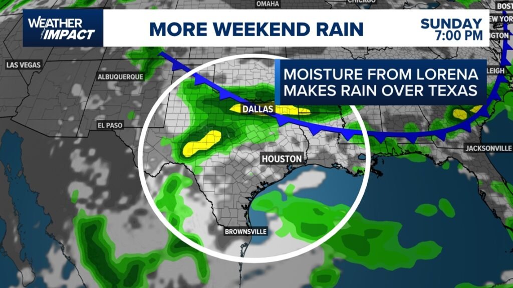
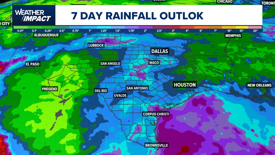
A surge of moisture from this system is expected to move into Texas by Sunday and Monday, Sept. 8 and 9, 2025. This is something folks in central and south Texas need to keep an eye on because this system can fuel heavy rain in the Texas Hill Country, a region affected by the July 4 floods. Some areas can receive 2-5” of accumulated rainfall through next Monday afternoon in central and south Texas.


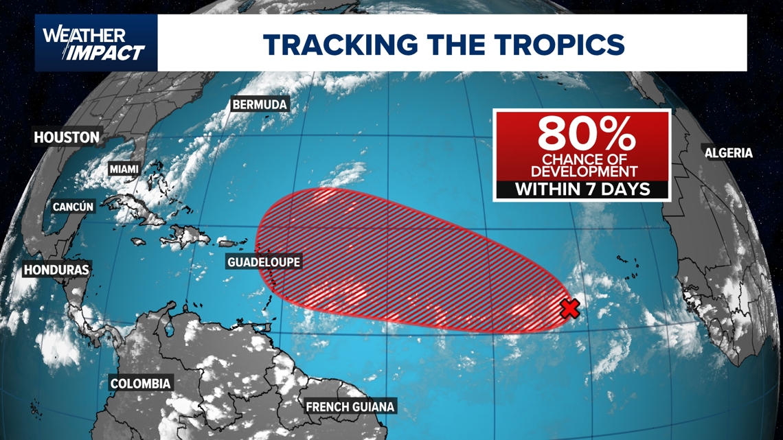
In addition, in the Atlantic Basin, the National Hurricane Center has highlighted an area that now has an 80% chance of development within the next seven days. This system is expected to move westward at around 15 mph across the central Atlantic early next week. It is too early to tell if this system is going to impact the U.S or the Caribbean, but it is something that we are going to have to watch closely in the coming days.