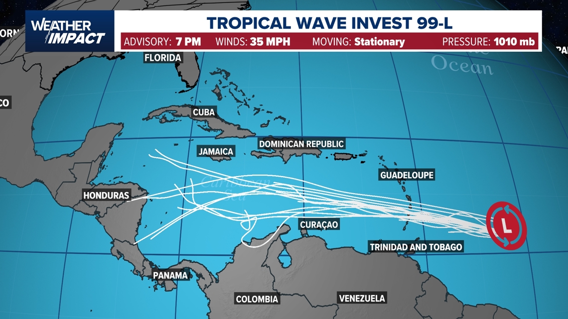
A second tropical wave will bear watching over the coming days as it moves into the Caribbean.
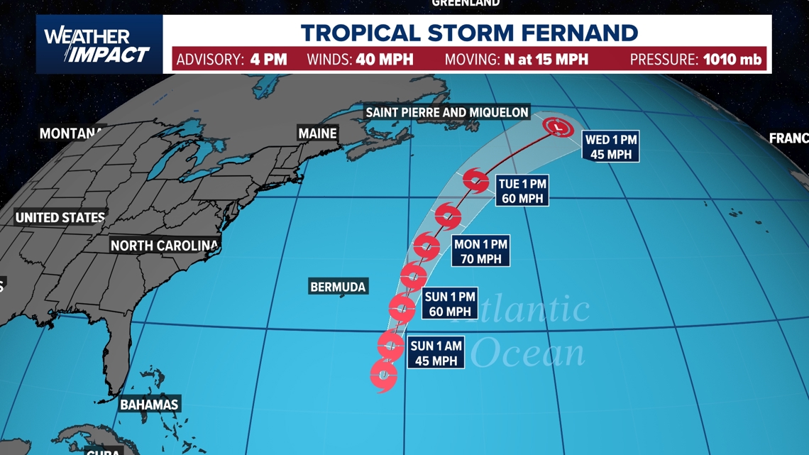
HOUSTON — Tropical Storm Fernand formed Saturday afternoon far out in the Atlantic Ocean. It is forecast to head north in the next several days and slowly strengthen. It is not a threat to the US and is forecast to pass to the east of the island of Bermuda on Sunday and Monday. It should gradually weaken by midweek as it moves farther north over cooler Atlantic waters.
Elsewhere, Erin transitioned to a non-tropical system and is moving away from the US over the far north Atlantic. Improving beach conditions are expected along the US East Coast this weekend as Erin pulls farther away.
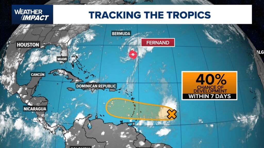
One other disturbance, Invest 99, is east of the Caribbean Islands and is set to move toward the Windward Islands by Sunday and Monday as a messy slug of moisture. Some gradual development is possible, but most models keep this system from organizing due to hostile conditions over the Caribbean Sea.

Got a news tip or story idea? Text it to us at 713-526-1111.
Our 2025 Hurricane Season special — “Eye on the Storm: Houston’s Fight to Weather What’s Next” — is now available. Chief Meteorologist David Paul, along with meteorologists Chita Craft, Pat Cavlin, Kim Castro, and Chris Ramirez, break down the science of the storm, and how to make sure you stay out of harm’s way.