The conditions are in place, and tropical system activity in the Atlantic Basin is starting to pick up.
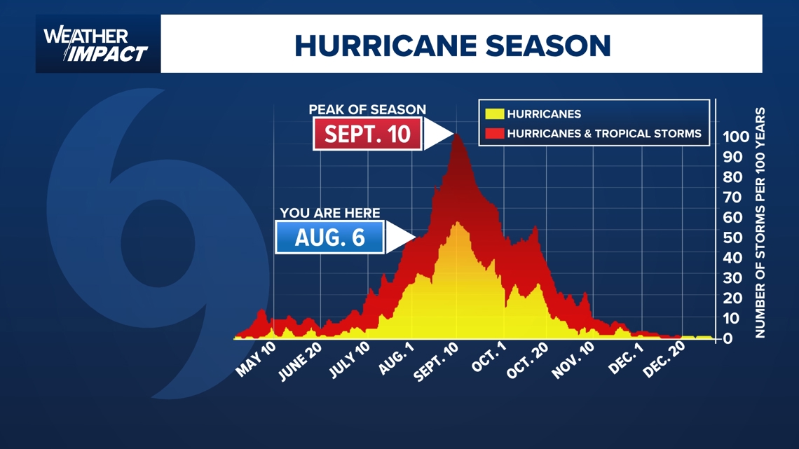
HOUSTON — We’re in the middle of the summer, and the Atlantic hurricane season is entering its most active stretch, with conditions quickly ramping up as we approach the climatological peak on Sept. 10.
After a relatively quiet start, recent days have seen a notable uptick in tropical activity, signaling the transition into the heart of the season.
Recent and active storms
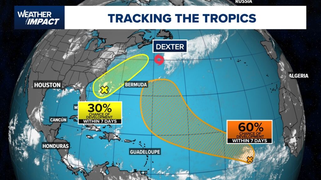
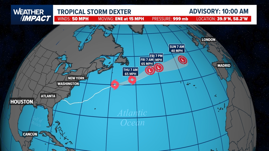
So far in 2025, the Atlantic has seen four named storms: Andrea, Barry, Chantal, and Dexter. The most recent, Tropical Storm Dexter, developed over the weekend.
As of Wednesday, Dexter sits northeast of Bermuda, with minimal winds, but is expected to accelerate northeastward and dissipate near Great Britain late next week, sparing land from direct impacts.
Elsewhere, a stalled front off the Carolinas is under surveillance for possible development, with the National Hurricane Center assigning about a 30% chance of tropical formation later this week. Models suggest this disturbance could bring some rain to the U.S. southeast, but so far, the threat of significant flooding remains low, with expected rainfall totals generally below 2 inches. This is a relief for communities in the Carolinas, still wary after damaging floods from a tropical system last year.

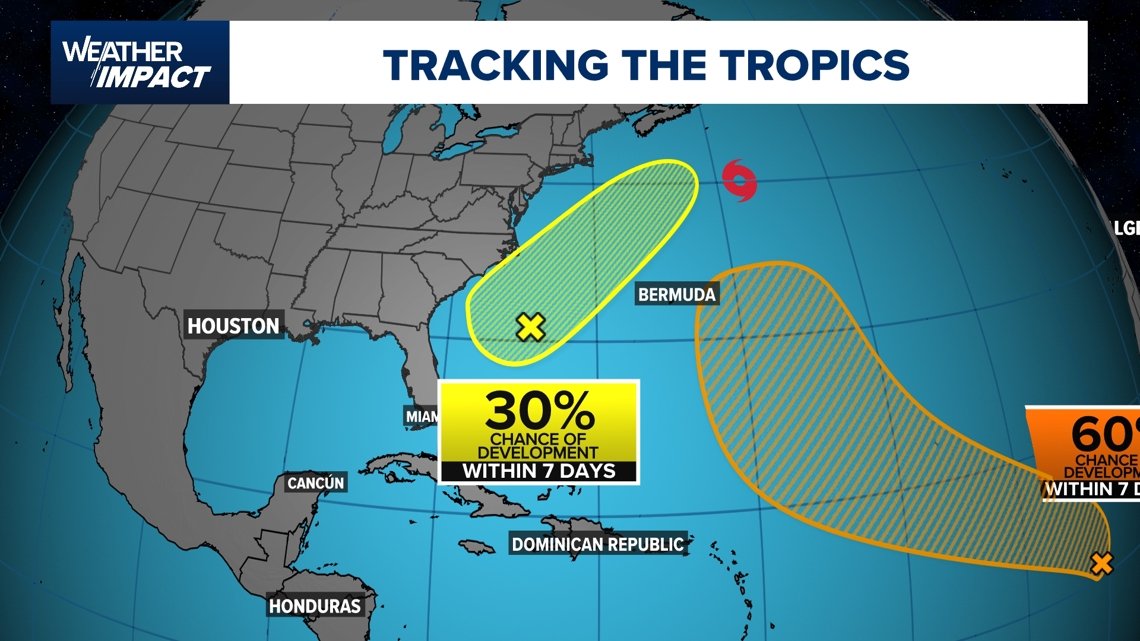
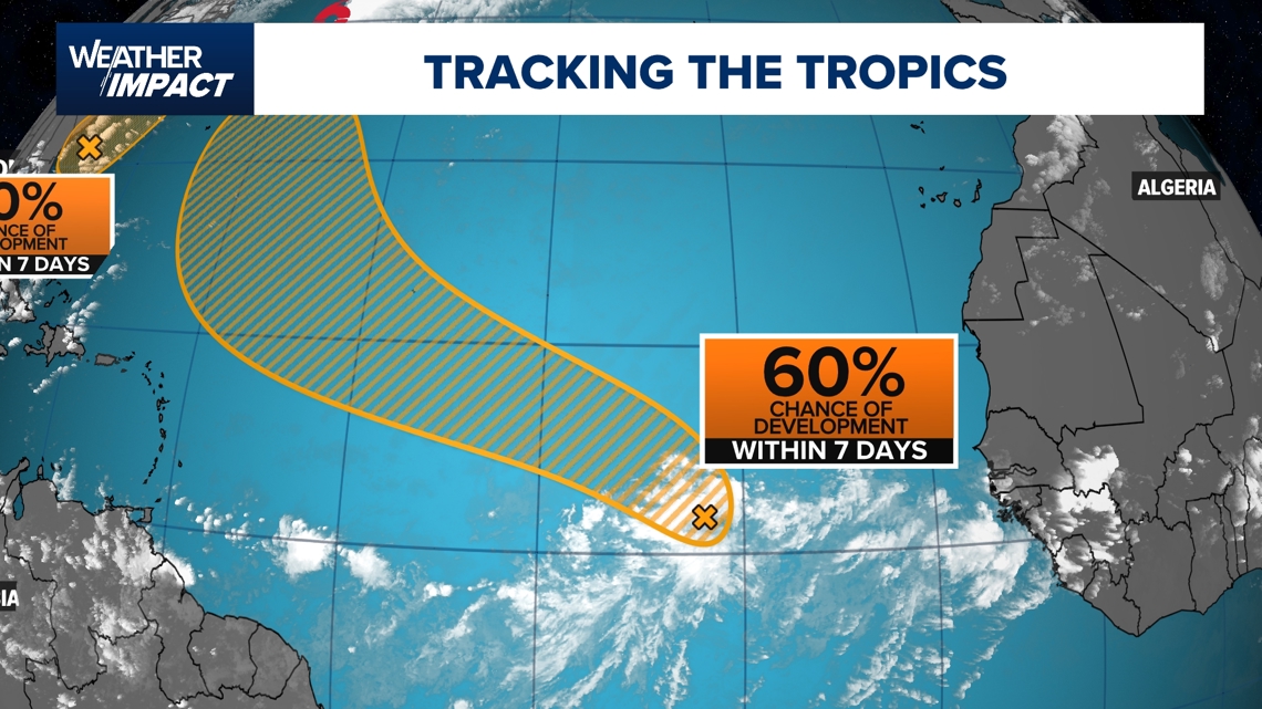
Further east in the open Atlantic, a strong tropical wave is showing signs of organization but is also contending with factors like wind shear and dust, which might prevent development. While early model runs hinted at potential formation, more recent updates now project that this disturbance will remain disorganized. This system has a 60% chance of development within the next 7 days.

Ocean temperatures: Warm, not wild
Sea surface temperatures across much of the Atlantic remain slightly above average for early August — one of the reasons for an active outlook this year. Some regions are running 1–3° above normal, especially near the Gulf of Mexico and Western Atlantic. Warm water is a prerequisite for hurricanes, but other ingredients such as atmospheric moisture, waves, and low wind shear are also necessary for development.

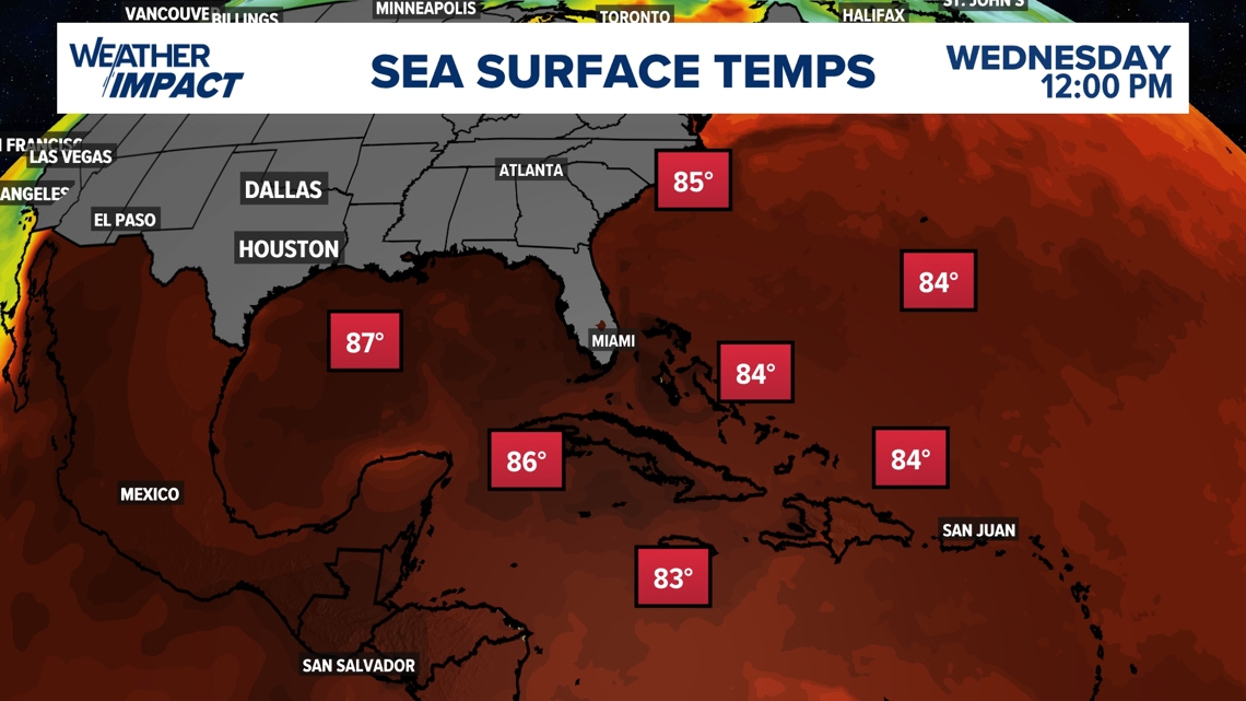
Currently, one limiting factor is the presence of Saharan dust blowing off Africa. This dry, sinking air suppresses storm formation, and as long as pockets of dust remain, they may limit how many disturbances manage to organize into named systems.
Hurricane season’s prime months
Historically, August through October make up the most active months for hurricanes in the Atlantic Basin, with September standing out as the statistical peak. The majority of tropical storms and hurricanes form during this period, with over 90% of activity by the Accumulated Cyclone Energy (ACE) index occurring between August and the end of hurricane season in November. A secondary peak sometimes occurs in late October before activity tapers off rapidly, going into winter.

Forecast: A busy few weeks ahead
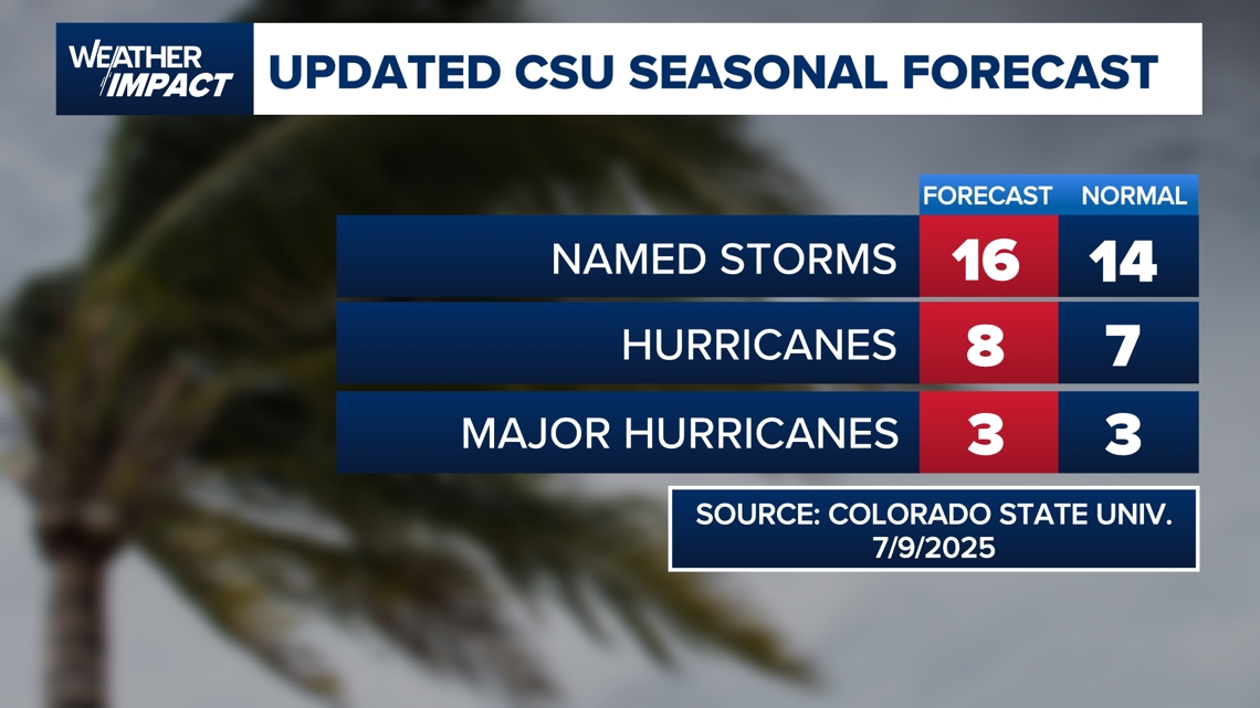
Colorado State University’s latest midseason outlook maintains a slightly above-normal forecast for 2025. The team now predicts 16 named storms, 8 hurricanes, and 3 major hurricanes — very close to last year’s above-average season, and higher than the 30-year average of 14 named storms, 7 hurricanes, and 3 major hurricanes. Meteorologists stress, however, that the number of storms does not indicate where they’ll form or whom they might impact — making ongoing vigilance essential.

Outlook: Stay weather-aware
With the seasonal ramp-up now underway and several suspect areas under close watch, meteorologists warn that the tropics can change rapidly — sometimes in less than 24 hours. For the U.S., there are currently no systems threatening the Gulf of Mexico or the mainland, but with activity expected to remain high through early October, forecasters urge residents to stay informed and ready in case tropical threats arise.
For now, the tropics are heating up, but so far, the storms are spinning safely out to sea.