This list of high-water spots from Houston TranStar will be updated automatically.
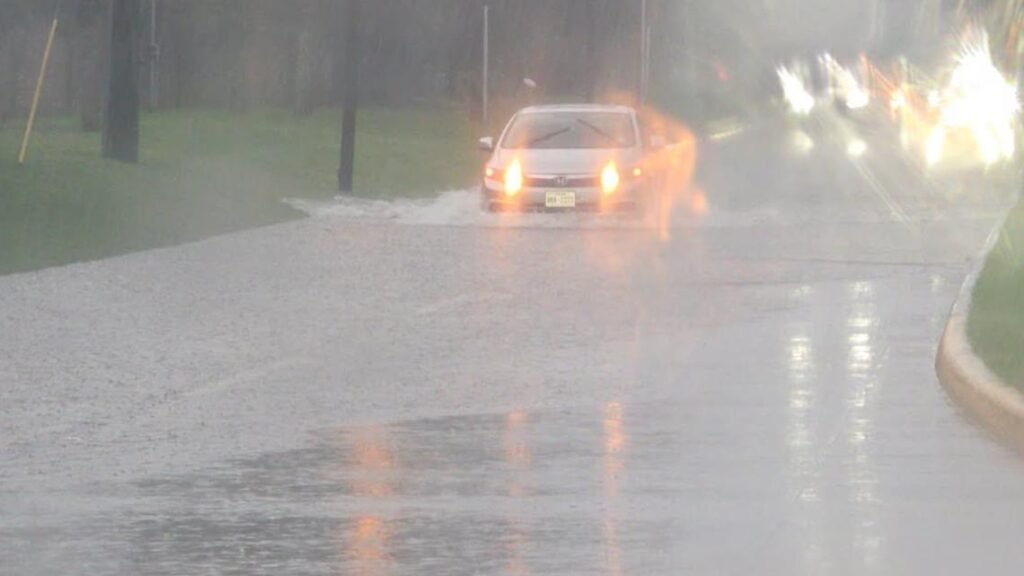
HOUSTON — Here in Houston, it doesn’t take a lot of standing water to damage your car.
You can lose control or stall in less than six inches of water. In just a foot of water, your car can start to float. In only two feet of water, your car can easily be carried away while you’re still in it.
If you encounter any high-water spots, remember the saying: “Turn around, don’t drown.” If floodwaters rise around your car, abandon the vehicle and move to higher ground.
Below is a list of high-water spots, as reported by Houston TranStar. A little before 7 p.m., Harris County Precint 4 also reported high water in the 17600 block of Timber Forest and the intersection of Will Clayton and Eagle Springs.
Check bayous and streams
In the Houston area, floodwaters don’t only come from the skies, but from the rivers, creeks and bayous.
In Harris County, you can check on levels on the Harris County Flood Control website. There, you can check the status of bayous and creeks across the county by turning on different layers of the map.
The state also monitors water levels, which is updated multiple times a day. You can monitor that here on the state’s site.
The National Weather Service tracks these water levels multiple times a day and makes the information available online.
Interactive traffic map